Geology of Pāuatahanui Inlet
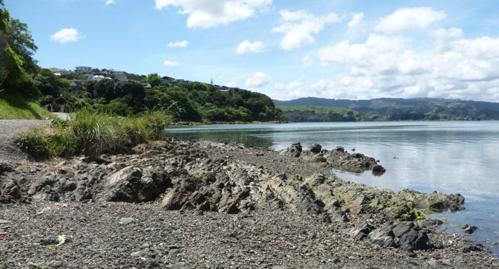
If you walk around Pāuatahanui Inlet you will see many rocky outcrops, both in the cliffs and on the shores that surround it. These outcrops often show layering with variations in texture, colour and hardness. The layers also vary in thickness and are tilted close to vertical. The layers alternate between fine-grained argillite, a hardened clay, and greywacke, a medium-grained sandstone. Greywacke (from grauwacke, the German for ‘grey rock’) is a well-known name in the Wellington region and is seen throughout the Inlet’s catchment and, in fact, throughout New Zealand, where much of the mountain chains of the North and South Island are built from it. It is what forms the basal rock structure of these islands.
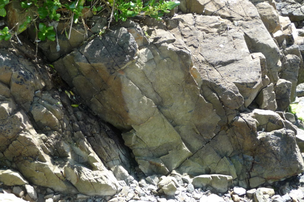
The greywacke and argillite are made from sediments deposited in the ocean a very long time ago and over a very long duration. The timeframe is from 255 to 170 million years ago (mya), spanning the two periods known in geological circles as the Triassic and Jurassic. The sediments consisted of mineral grains eroded from granitic mountains and washed into the sea by ancient river systems. During the erosion, coarser grains settled first, close to shore, while finer particles were carried further out to sea, settling slowly to build up muds on the deeper ocean floor. Periodically the coarser sediments were redeposited into deep water by submarine avalanches called turbidity flows, probably triggered by many earthquakes. In this way, alternating layers of sediment developed resulting in the layered rock pattern that we see today. This process continued for many millions of years in a deep trench located off the coast of an ancient super-continent called Gondwana, when Australia and Antarctica were not separate continents but part of a single, very large, landmass. As the sediments continued to thicken, deeper layers became compacted, and heated, and slowly turned into rock.
About 120 mya, in the Mid-Cretaceous, crustal movements pushed the offshore deposits up against the margin of Gondwana, compressing and folding the consolidated sediments which rose up out of the sea to form a new, and extensive, mountainous land. Complex folds and faulting caused the originally horizontal layers to be tilted, sometimes vertically, and broken up into many larger and smaller blocks.
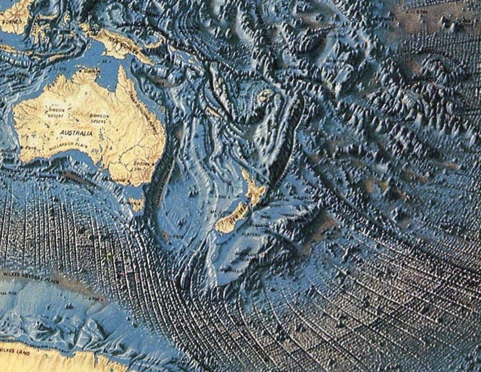
Between 80 and 60mya, towards the end of the Cretaceous and after a long period of stability, a rift formed inland that caused this block of land to separate from Gondwana creating, in the process, the sub-continent of Zealandia and the Tasman Sea. This separated land gradually moved eastwards into the Pacific, sinking slowly as it did so, during which time erosion wore the mountains down to a low lying, gently rolling, landscape called a peneplane, with flat surfaces produced by wave action at the margins. The remnants of this surface can be seen in many places around the Wellington region. Mana Island shows a typical example of the flat-topped surface created during this time. Much of the peneplane became covered with younger, shallow marine mudstone and limestone.
Total submergence was averted when, around 23 mya (in the Miocene), a renewed phase of mountain building began pushing the land up again. Some geologists claim that the land did become totally submerged, while others believe the highest peaks remained above sea level. Either way this new phase of uplift was to create the Southern Alps and the North Island backbone of hills, such as the Remutaka Range and the hills of the Wellington region. Most of the younger sediments were eroded away during this period, exposing the old bedrock which was then sculptured by weather and erosion into the landscape we see today.
Pāuatahanui Inlet is, therefore, surrounded by 200 million-year old, Triassic/Jurassic, ‘basement rocks’.
The only other geological periods represented here are very much younger scattered patches of unconsolidated (loose) sediments from the Pleistocene, less than 2.5mya, lying on top of the old bedrock. The onset of the Pleistocene Ice Age resulted in several periods of very low sea level when global glaciation stored up vast quantities of water, starving the oceans of their supply. In between the glacial episodes, interglacials occurred where the climate was as warm, or warmer, than it is today. The last glacial period, 22,000 years ago (ya), was the most extensive, with sea levels estimated to have been 130m below the present levels. Pāuatahanui Inlet was then a dry river valley that continued out to a coastline situated beyond Mana Island. (The sea floor map, right, shows a submerged coastline with evidence of river outlet just to the west of central NZ). It was part of a major fault-controlled river system that flowed westwards from Upper Hutt and through the Judgeford basin, a route that is now traced by the Haywards Hill road. The river built up wide terraces of gravels created by ice-fracturing of rocks from the cold, barren hilltops and it cut deep valleys as it kept pace with the lowering sea level. In some places layers of windblown silt called loess were deposited on the river gravels. These conditions lasted for thousands of years during the last glacial episode before the climate warmed and developed into the present interglacial conditions.
The present warm Holocene epoch began around 10,000ya. Global sea levels rose for the last time, inundating Cook Strait and very rapidly flooding the Pāuatahanui river valley, to reach its present level about 7,000ya. The Inlet’s coastline, initially sloping down to low-water mark, was eroded by wave action to create small cliff faces and a wave-cut platform around the edge. Fine sands, muds, silts and peats were deposited over the gravel layers as the forests returned to the surrounding hills. A sand bar formed at the entrance to the Inlet, narrowing the gap, on which the Mana Esplanade is now built. The old river bed, in some places around 13m below the current harbour floor, began to be covered with accumulating sediment from the rivers and streams that flow into the Inlet, a process of infilling that continues naturally today.
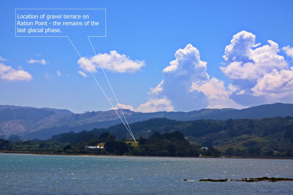
Despite flooding of the valley, remnants of the old river terraces, and a few marine deposits, can be found in several places around the shore as gradual tectonic uplift has raised them above the current sea level. Ration Point is one such site where the elevated bluff is covered by a bench of gravels from the penultimate glaciation. Another, more recent terrace, is situated behind the Pāuatahanui village on which St Alban’s church is built, originally the site of Te Rangihaeata’s pa.
The southern margin of the Inlet is surrounded by elevated cliff faces showing very weathered basement rocks, stained with iron oxides that give a reddish colour. These are the remains of an eroded landscape dating from the time of the peneplane phase when intense weathering took place. Much of this material has been removed during glacial times but there are local isolated outcrops like this one.
The tectonic movements associated with our, still-rising, landmass, as evidenced by the recent Kaikoura uplift, have created many faults, some of which cross Cook Strait and track up the North Island. Movement and uplift on these faults have significantly changed the landscape. One effect was to raise the Western Hutt hills, diverting the old river course so that it now follows the Wellington fault down to Te Whanganui-a-Tara, Wellington Harbour. The current Pāuatahanui Stream is therefore much smaller than the old river used to be.
The natural drainage systems in the catchment are almost entirely fault controlled and most show a marked parallelism, with a direction five degrees west of north, due to faults that were active during the Ice Age. The modern active faults trend north-east: the Pukerua, Ohariu, Ration Point and Moonshine faults. The most important of these is the Ohariu fault. This was responsible for the creation of the Onepoto Arm which formed first by river erosion along the fault-crush zone prior to flooding by rising sea levels. From there the fault runs under the Paremata Bridge and across Pāuatahanui Inlet to follow the Kakaho Stream. It has been estimated that between 1070 and 1130 ya, an earthquake of 7.1-7.3 magnitude caused the Ohariu fault to rupture with a horizontal displacement of 3.7 m. An aerial view of the Kakapo valley shows the dog-leg paths of tributaries resulting from movements of this fault line.
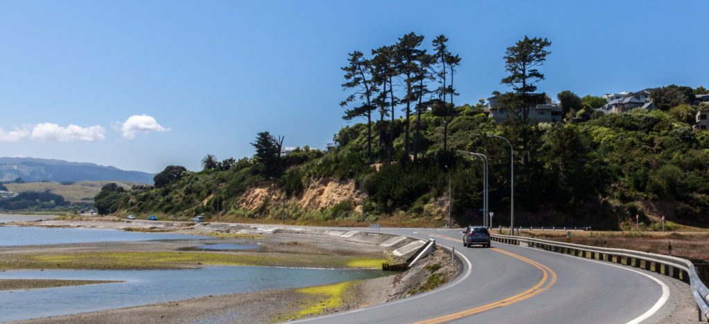
However, the most significant geological event for the Inlet in recent times was the 1855 Wairarapa earthquake that raised the whole catchment by up to 1.5 m. This uplift resulted in further shallowing of the Inlet and the exposure of the wave-cut platforms on which the roads have been built. Up until this time smaller ships were able to navigate up to at least Ration Point where there once was a customs house. Prior to 1855 the Pāuatahanui Stream entered the Inlet via a broad estuary. The uplift raised 40-50 ha of tidal flats creating a saltmarsh. It is on this newly exposed wetland area that the current Wildlife Reserve is situated.
The present geomorphology of Pāuatahanui Inlet is a result of tectonic faulting and uplift of the 200 million-year-old basement rocks, river erosion and re-deposition of sediments, and fluctuating sea levels through cycles of climate change. The history of the Inlet is written in the land.